Information Possibly Outdated
The information presented on this page was originally released on June 14, 2007. It may not be outdated, but please search our site for more current information. If you plan to quote or reference this information in a publication, please check with the Extension specialist or author before proceeding.
4-H photo re-enactment uses modern technology
By Courtney Coufal
MSU Ag Communications
MISSISSIPPI STATE -- In celebration of the Mississippi 4-H centennial, the organization's members, agents and volunteers re-enacted a decades-old activity using modern technology.
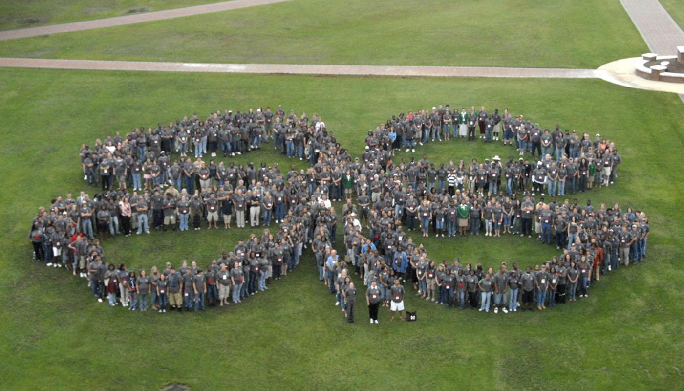
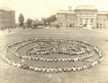
During the 2007 4-H Congress, more than 600 4-H'ers gathered in the shape of a clover leaf for a photograph on Mississippi State University's historic Drill Field. Mississippi youth formed a similar design 80 years ago at the first 4-H Congress in 1927 and then again several times in the following years. However, instead of freely forming the familiar 4-H logo as was done decades ago, this time organizers created a 100-foot-wide clover-leaf perimeter using a Global Positioning System satellite and Geographic Information Systems.
Jim Lytle, chief photographer for the MSU Office of Agricultural Communications, coordinated the event and said he wanted to create the shape as close to perfect as possible, so free-forming it was not an option.
“Knowing the unique shape of an actual clover leaf, if we tried to free-form it, the odds of getting it close to what it looks like were minimal,” Lytle said. “I thought if we were going to do this for the 100th anniversary, I wanted to do it the best way possible.”
Louis Wasson from the GeoResources Institute at MSU explained GPS as a system of Earth-orbiting satellites and a receiver on the Earth's surface. The satellite tracks the receiver by using longitude and latitude points. The receiver can be a hand-held unit or a fixed unit such as those used in cars for navigation systems.
Creating the clover-leaf perimeter involved several steps, Wasson said.
“We took the logo and enlarged it to 100 feet across, then made a map of the logo on the Drill Field using GIS software. Next, we transferred the logo map to a GPS receiver so we could go out to the Drill Field and walk the 100-foot logo using GPS,” Wasson said. “It sounds simple and it is, but there are a lot of little details that needed to be accomplished before the logo map was transferred to the GPS receiver.”
Wasson used GIS software and geo-referencing to create the map that was transferred to the GPS receiver. GIS is a way to display and analyze geographic data that have latitude and longitude information, like a road map or atlas, he explained. Geo-referencing assigns latitude and longitude points to objects, such as the 4-H clover leaf.
“We brought the image of the campus into GIS software and zoomed in on the Drill Field. We then drew a 100-foot square on the image where we wanted the logo to go (in the southwest corner of the Drill Field),” Wasson said. “Then we stretched and geo-referenced the 4-H logo to fit the dimensions of the 100-foot square. The final result is a map showing the 100-foot-wide 4-H logo correctly positioned on the Drill Field with precise geographic coordinates.”
At that point, the clover-leaf map was transferred to the GPS unit, and 4-H volunteers walked on the Drill Field with hand-held receivers and placed survey flags at the specific plotted points to create the shape of the clover leaf.
The 4-H'ers filled in the plotted areas, creating a precise outline of the uniquely shaped clover leaf, Lytle said.
“The GPS made a huge difference. If you look at the pictures taken in the 1920s and 1930s, you can tell that they were free-formed,” Lytle said. “They came close to the shape but were not able to achieve the precision that we did using this technology.”
Research for GPS and GIS application continues, Wasson said, but it has already had a significant impact on the agriculture and forestry businesses, especially precision agriculture.
“In precision agriculture, for example, a farmer is able to pin-point specific areas of pest or weed infestation in his field using aerial imagery or a GPS receiver. He can then spray that particular area and not have to spray the whole field. This has a positive impact on the environment and keeps costs down.”
As spatial technology becomes more available, it has already proven worthy for the 4-H'ers. Susan Holder, state 4-H program leader, said this project provides a glimpse into what 4-H is about today.
“We still have many of our traditional projects and some of the youth activities that were important decades ago, such as livestock, agronomy, cooking and clothing,” she said. “We also have projects that stretch modern technology and activities, projects that 4-H members could not have dreamed of a century ago, such as computers and engineering.”


